GEOG 3110 - The Earth From Space:
Remote Sensing of the Environment


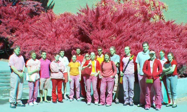
Photogenic Geography 3110 students, in a color infrared photograph

Meets Mondays and Wednesdays, 1:25-2:45pm. Taught by Dr. Philip Dennison, who has over 15 years of experience in the field of remote sensing. Questions? Contact dennison@geog.utah.edu


Over the past decade there has been an extraordinary increase in the availability of remote sensing images of Earth. The explosion in the availability of remote sensing data has coincided with a growing number of remote sensing applications. Remote sensing data are now used in anthropology, civil engineering, environmental sciences, geography, geology, hydrology, natural resource assessment, meteorology, and urban planning. In this course, we will examine remote sensing science, techniques, and applications. Five lab exercises will give us “hands-on” experience with real remote sensing data. Do you wonder about what satellites can measure from space? Curious about how Google gets all the imagery you see in Google Maps? Want to know how we can measure climate change from space? This is the class for you!


Click on the following links or scroll below to see some of the topics we will examine in this class.

Remote Sensing Science

Remote Sensing Applications

The Electromagnetic Spectrum

Vegetation

Aerial Imagery

Soil and Rock

Multispectral and Hyperspectral Remote Sensing

Water

Thermal Infrared and Radar Remote Sensing

Urban Landscapes


The Electromagnetic Spectrum

  • Important regions of the electromagnetic spectrum for remote sensing
  • Wavelength, frequency, and energy
  • Atmospheric windows
  • Passive and active remote sensing


The electromagnetic spectrum (NASA)


Aerial Imagery

  • Advantages and disadvantages of aerial imaging
  • How to interpret images
  • History of remote sensing


A 1-meter spatial resolution aerial image of Rice-Eccles Stadium (USGS)


Multispectral and Hyperspectral Remote Sensing

  • Remote sensing and image display using multiple bands
  • Spectral signatures of materials
  • Earth observation remote sensing


Two infrared bands and one red band from a Landsat image of the eastern Salt Lake Valley (USGS)


Thermal Infrared and Radar Remote Sensing

  • Thermal emission
  • Remote sensing of temperature
  • Radar bands
  • Radar backscattering
  • Measuring elevation using remote sensing

Landsat data draped over a digital elevation model derived from Shuttle Radar Topography Mission (SRTM) data (NASA JPL/USGS)


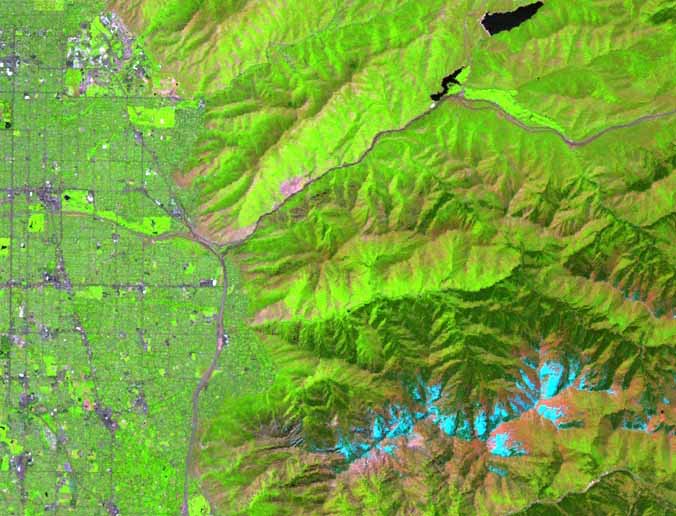
Remote Sensing of Vegetation

  • How plants reflect, absorb, and transmit light
  • Vegetation mapping
  • Vegetation indices


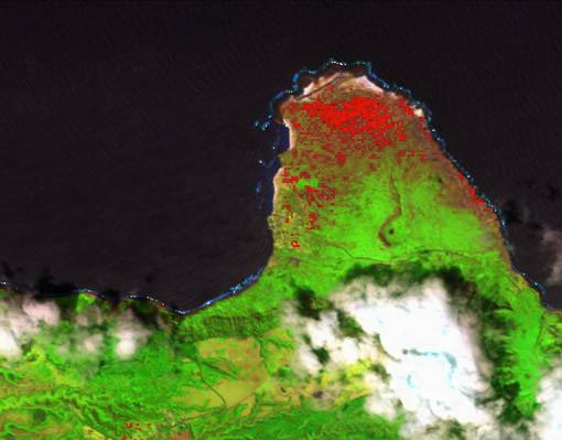
Red pixels indicate the presence of Lantana, an invasive species in this AVIRIS image of the Kalaupapa Peninsula, Molokai, Hawaii


Remote Sensing of Soil and Rock

  • Minerals
  • Soil grain size
  • Soil moisture


A mineral map of Cuprite, Nevada derived from AVIRIS data (USGS)


Remote Sensing of Water

  • Water depth
  • Sediment concentration
  • Phytoplankton


Colors indicate chlorophyll concentrations in this SeaWiFS image of the coast of British Columbia, Canada (NASA)


Remote Sensing of Urban Landscapes

  • Urban materials
  • Land cover vs. land use
  • Lidar
  • Population


A composite of DMSP "night lights" data shows the locations of urban areas around the world (NASA)